INDEX
_______________
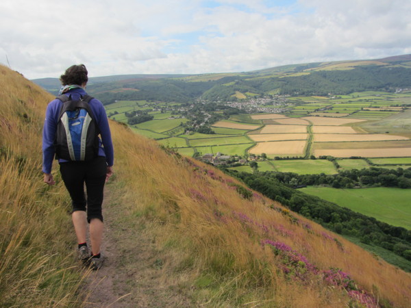
Hills above Bossington
After our previous weekend in West Somerset/North Devon in October 2011, we returned to Minehead to explore some different walks in this beautiful corner of the West Country. We stopped off on Friday to enjoy a hearty lunch at The Plough in Holford at the foot of the Quantock Hills.
In the afternoon we drove along the old military road that runs from Minehead along the spine of North Hill and parked at its western extremity, with stunning views across Porlock Bay to Foreland Point from a height of 280 m (920 feet). There are many walking options from here, and this time we walked to the top of Hurlstone Combe and took the cliff path which runs above Bossington, (photo above, taken on a previous visit) looking like a toy village 200 m (650 feet) far below. The path gradually descends past Church Combe to the bottom of Lynch Combe, where the steady climb back up to the car park commences. The walk is only about 3 miles (but can feel like more) and was completed comfortably in a couple of hours, even with frequent stops to admire the views.
In the evening we had supper at The Old Ship Aground at Minehead harbour opting to eat in the restaurant area, as Friday is live music night in the bar. This pub has had mixed fortunes and even closed for a while, but it is now run by a local farming family and offers excellent beer, food and friendly service.
Saturday dawned wet and grey and the rain and mist intensified as we headed west across Exmoor through Porlock and Lynmouth to the Heddon Valley, over the border in North Devon. We parked at The Hunters Inn nestling in the Heddon Valley.
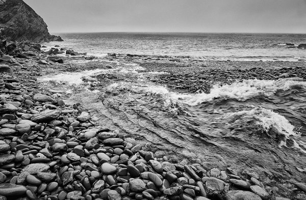
By now it was raining hard, so we walked along the relatively sheltered path to Heddon’s Mouth. This is now just a remote stony beach where the river flows into the sea, but a restored lime kiln overlooking the beach reveals some of its history. In the past limestone was burnt to create quicklime for spreading on the local fields to improve the acid soil. The limestone was brought by ship from South Wales together with culm, a mix of low quality coal and lime. The boats were then reloaded with timber for pit props in the South Wales coal mines and refloated on the next tide.
We retreated to the shelter of the Hunters Inn for a lunch of delicious Devon crab sandwiches, washed down by the locally brewed Exmoor Ale. 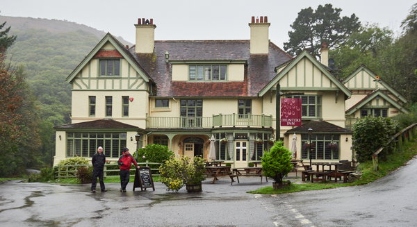
The weather brightened up in the afternoon, so we drove back up to one of the car parks below Trentishoe Down. We joined the South West Coast Path, which runs along the beautiful and aptly named High Cliff at a height of 240 m (790 feet) before turning south on the Tarka Trail to go through the tiny hamlet of Trentishoe, no more than a church, a farm and a few cottages sheltering in a small combe, before heading back to the car. The Great Hangman, which can be seen just west of here, is the highest sea cliff in England and Wales at 318 m (1043 feet), of which 244 m (800 feet) is a sheer drop.
Supper was taken in the Luttrell Arms in Dunster which was very busy with a cider festival and more live music, fortunately at the other end of the bar. We enjoyed excellent food and service, although we felt that there would be less confusion if they had visible numbers on the tables. Even the staff seemed to be confused about which table we were occupying!
Sunday dawned bright and sunny. Leaving Minehead and Exmoor behind, we drove back east along the A39 to Holford to walk in the Quantock Hills. Many people head straight for Exmoor and miss the beauty of the Quantocks, but they really are worth spending time to explore. Although outside the Exmoor National Park, they have been designated as an Area of Outstanding Natural Beauty. We parked in the car park at the back of the village and walked south for about a mile, gradually climbing to the cairn at the summit of Higher Hare Knapp at 312 m (1020 feet). 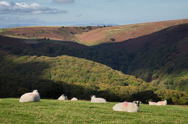
The views from here are stunning, looking north across the Bristol Channel to the islands of Steep Holm and Flat Holm, with only the Hinkley Point nuclear power station site detracting from the rural outlook. The views in other directions are of wild moor and wooded combes, with no signs of human interference. No wonder Coleridge and Wordsworth found it so inspiring!
We then had an excellent Sunday roast at the recently reopened Hood Arms in Kilve to sustain us for the drive back to the flatlands of East Anglia.